


Urban Forests Application
Unifying urban forestry data across Canada
I led design for Canada's first national urban forestry data hub, built for the Canadian Institute of Forestry in partnership with UBC's Urban Forestry Program. Before it existed, urban forestry data was scattered across incompatible, disconnected municipal portals, unusable at any real scale. What launched now holds over 4.3 million tree records across every province and territory, the first tool of its kind in Canada. I worked across both phases, from research through implementation, and sat on the project's National Advisory Committee, which reviewed and approved deliverables.
Problem
Urban forestry data in Canada exists, but it is unusable at any real scale. Municipal portals weren't centralized or connected, used incompatible standards, and updated on different schedules. Interviews confirmed the core problem was time and access. Finding, acquiring, and reviewing data took far more manual work than it should, made worse by that same lack of standardization, and for small teams the effort often wasn't worth it. Compounding that, some public trees were never inventoried at all. Reducing that manual burden and standardizing what data looked like nationally were goals nearly every user shared, aligning directly with the business goal of a centralized hub.
Approach
I decided what urban forestry data users actually needed to see, and what would only get in the way. Reviewing the available datasets, I grouped attributes into three tiers. A small set became the main filters. More detail went into an individual tree's metadata popup. Attributes that showed up in fewer than five municipalities I left out of the interface entirely. Keeping every attribute in the popup would have meant a cluttered, inconsistent view that shifted from one municipality to the next. Instead, I standardized what users saw, while keeping those sparser attributes available in the full data download for individuals who needed them. A number of other features didn't make it into phase one, cut for budget rather than value. I flagged them early as work for a second phase, to be built out once funding came through.
Solution
Phase one delivered on the core problem directly, standardizing and consolidating data into one place. Users could drill into specifics, location, tree size, and species. Sharing what they found was just as easy, either by sending a link to their current view or downloading the data straight from the platform, including the sparser attributes I'd kept out of the main filters and metadata popup for consistency.
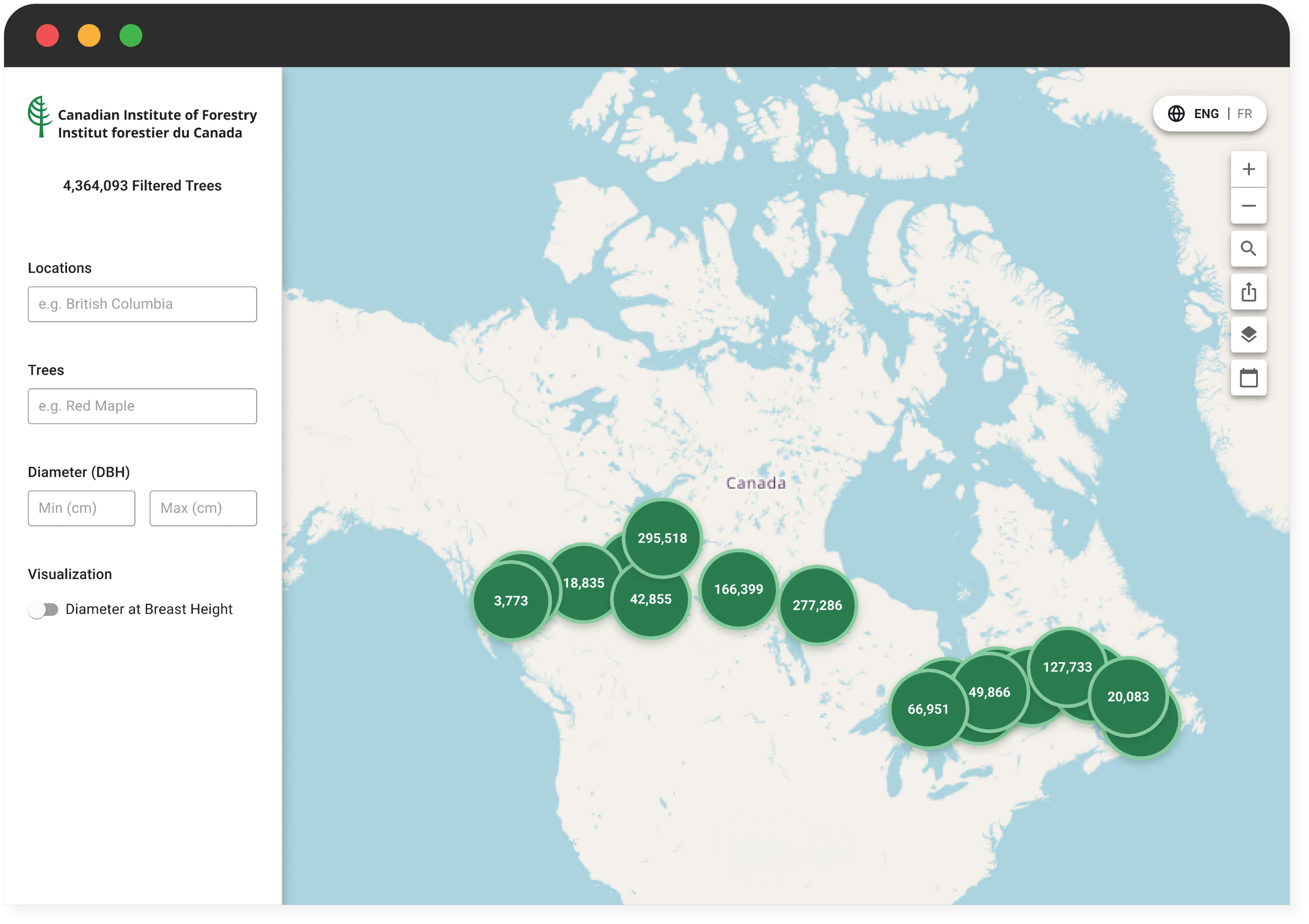
I picked up phase two once funding came through. AI entered the process throughout that phase, for design critique and rapid prototyping. Two new features closed real structural gaps. A contribution form gave municipalities a way to register interest in adding their data to the hub, aiming to get more of them into the standardized system. A year-by-year timeline resolved a data-integrity risk flagged early in the project, marking every record as new, updated, unchanged, or removed. The rest extended what the platform already did well, adding French translation and a set of visualization options for exploring the data in different ways.
Impact
The result is a single, centralized home for a category of data that had never been unified in Canada before, a meaningful outcome for the client and the sector it serves. What launched with a number of municipalities now holds over 4.3 million tree records. Working on this project reinforced that adoption tools need to remove friction, not just gauge interest. The contribution form proved municipalities wanted in, the next step is building a path that lets them actually contribute data, not just register interest in doing so.